FacilityBot allows users to add a Permit to Work (PTW) layer on the map dashboard. This layer displays active permits with annotated locations to be displayed on a map.
To enable this feature,
- Log in to the FacilityBot Web Portal.
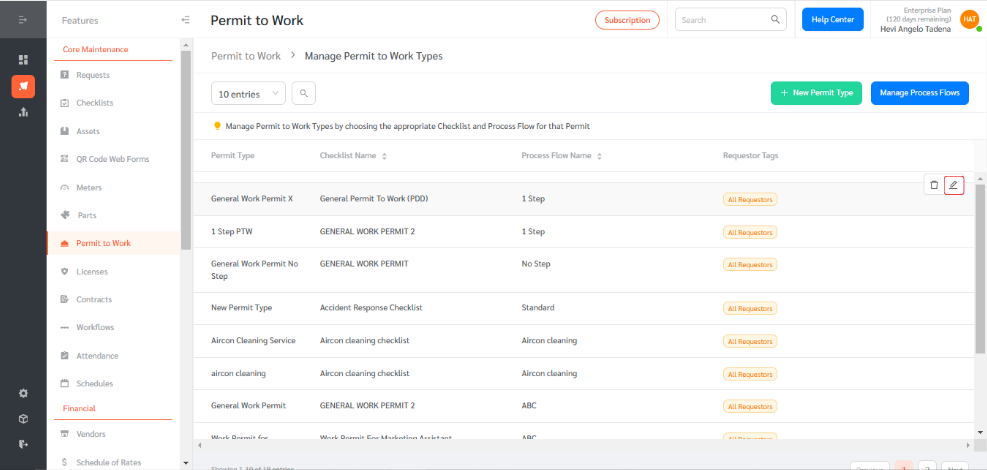
- Go to “Features” → “Permit to Work” → “Manage Permit Types”

- Hover over the permit type you wish to configure and click the pen icon to edit.
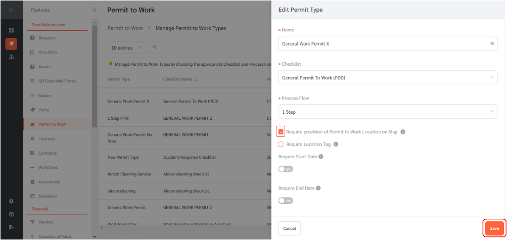
- Tick the box labeled ‘Require provision of permit to work location on a map’ to enable permits to appear on the map dashboard. Click save. Now, applicants can annotate a map to indicate the exact location where work will be conducted.
To annotate the permit to work in the map,
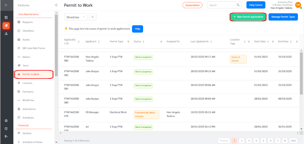
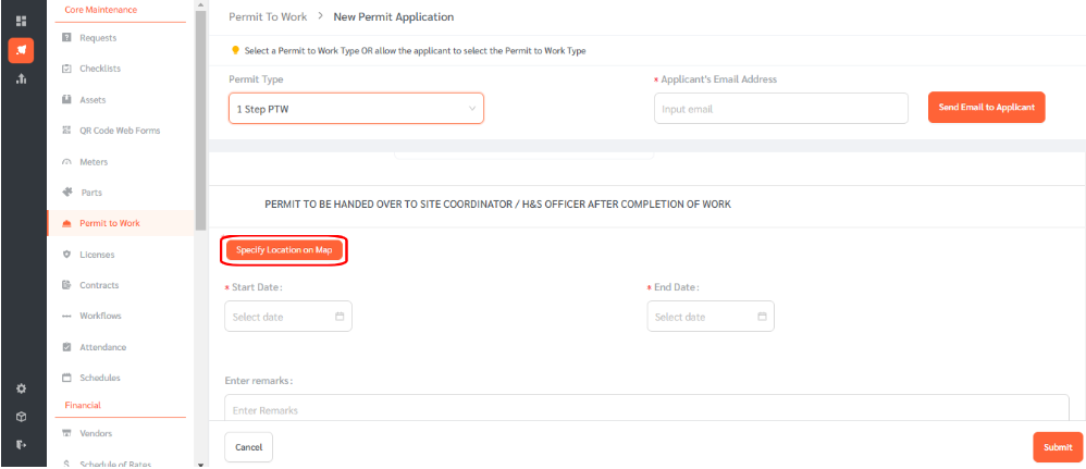
- Go to “Features” → “Permit to Work” → “New Permit Applications”
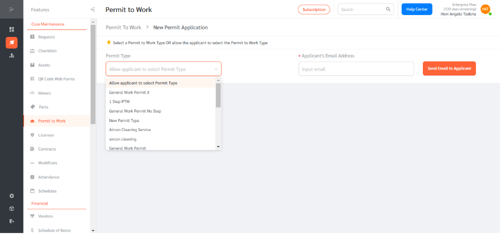
- Click on the permit type box and choose the relevant PTW Type.
- Complete the PTW checklist, scroll down, and click ‘Specify location on a map.’
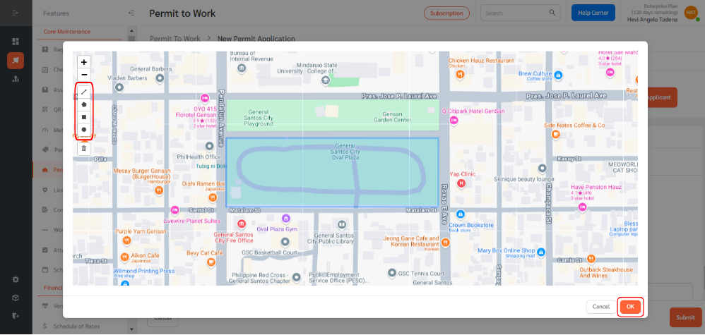
- Using the drawing tools, annotate the location on the map. You may use a line, polygon, rectangle, or circle. Click OK once done.
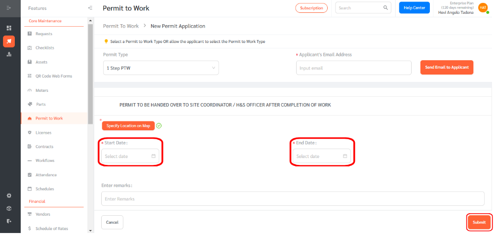
- A check mark will appear beside the ‘Specify location on map’ button. Now, set the start and end dates for the permit, then click submit.
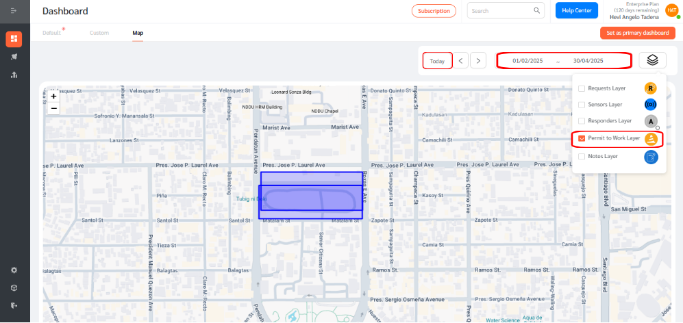
- To view the Permit to Work Layer, go to the dashboard page and select “Map.” Click on the layers icon.
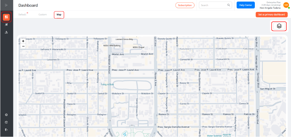
- In the Layers menu, check the box to display the Permit to Work layer. You can also filter permits by date range or select the ‘today’ filter for a real-time view.
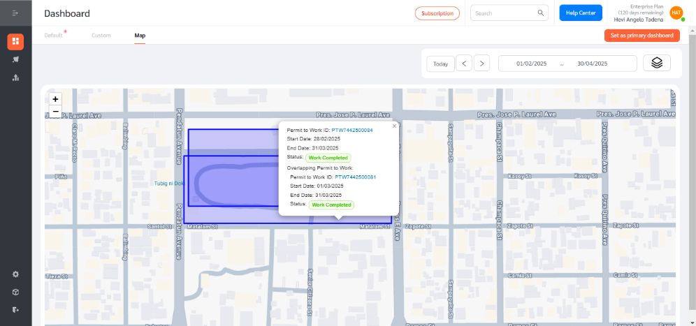
- Click on any annotated permit location on the map to view its details.
This feature enhances visibility and tracking of permits, ensuring better compliance and coordination in the workplace.